We’ve released a number of new ArcGIS for State Government Solutions, as well as, updates to existing offerings we previously shipped. Some of the highlights include updates to following offerings: Economic Development, Transportation and Environment and Natural Resources and Fish and Wildlife.
Economic Development
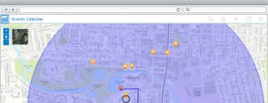
Event Locator is a web application deployed by Business and Economic Development Organizations to enable the public to explore activities and events going on across the state. The application enables citizens and tourists to create a virtual itinerary to see and visit the many sites and events throughout a state.
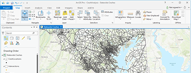 Crash Analysis is a solution that helps state transportation departments standardize their road segment datasets and assign roadway crash locations to specific roadway segments. Risk maps created from crash analysis results can help inform decisions regarding safety improvement priorities or crash mitigation measures.
A collection of 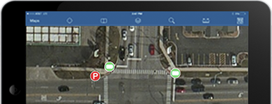 Asset Inspection Configurations for ArcGIS for Collector that facilitate field-based inspections for guardrail, signs, signals, streetlights and pavement markings. These configurations will enable inspectors to rapidly inspect sites they are responsible for and post their information quickly.
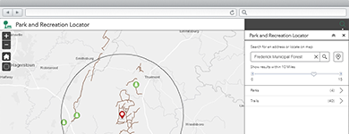 Park Locator- is an application used by the public to search for and discover recreational activities across the state. The application enables them to find parks and other activities by proximity, based on their interests, or based on amenities provided at each location.
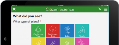 Citizen Science, – is a web application used to solicit information from the public or from within your organization to report sightings of invasive species, plants and animals. Sightings can be reported and reviewed to ensure accurate information is being collected and analyzed.
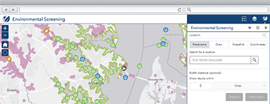 Environmental Impact, – is a web application that allows individuals to determine potential impacts of development projects on the natural environment.
Wildlife Management Area Locator, –
is a web application that facilitates access to Wildlife Management Areas (WMAs), enables them to discover the wildlife that typically resides there, and helps citizens understand what requirements have to be met to hunt or visit in the WMA.
We encourage you to explore the other new maps and applications we are building in support of the work our state government customers are doing. You can also explore the entire solution portfolio by industry, product or functional needs.

Article Discussion: