Vihiga adopts GIS technology in design of county projects
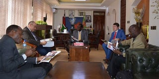
Vihiga governor Wilber Ottichilo (centre) and his deputy Patrick Lumumba (left) host a team from Esri last week at the county offices. PHOTO | COURTESY
France-based Airbus Defence and Space and US-based Esri together with Kenya-based LocateIT have selected Vihiga as a model county in a partnership that will see the deployment of space technologies and geographic information systems (GIS) to facilitate planning and management.
County governments in Kenya are still grappling with implementation of devolved governance since inception in 2013. One of the challenges is how to automate services to improve efficiency as well as seal loopholes through which billions of shillings are lost to corruption.
Again most county managers consider acquisition of fancy devices such as iPads and other mobile devices as a key plank in their policies for going digital.
The County Governments Act 2012 requires the devolved units to embrace spatial technologies in management of their affairs but many are yet to correctly implement this part of the law.
To bridge this gap three companies, France-based Airbus Defence & Space, US-based Esri and Kenya-based LocateIT have selected Vihiga as a model county in a partnership that will see the deployment of space technologies and geographic information systems (GIS) to facilitate planning and management.
GIS uses location-based data collected via satellites, paper maps, and directly from the field through mobile positioning devices to map out resources for analysis and decision-making.
Vihiga governor Wilber Ottichilo, a space technologies and GIS expert, implemented the technology when he was Emuhaya MP that saw him voted the best performing lawmaker based on his development record and use of Constituency Development Fund in May 2015.
“Esri, Airbus and LocateIT previously supported Governor Wilber Ottichilo during his tenure as Emuhaya MP where innovative use of space technology and GIS was deployed. Esri is keen to continue this support and further develop smart solutions for Africa, modelled on Vihiga under the leadership of Dr Ottichilo,” said Esri general manager, West Asia, Middle East and Africa, Sohail El Abd.
According to Erick Khamala, the managing director of LocateIT, the local partner of Airbus and Esri, the two global companies have donated a satellite image and GIS software to support implementation of the County Development Information System (CDIS) conceptualised by the Kenyan company and designed for Vihiga.
“The integrated system will help the county to efficiently manage its resources such as forests, water, farmlands, minerals, wildlife and wetlands. Our system will also support the county to develop spatial plans, land management information and enhance various social amenities such as schools, hospitals and dispensaries, markets, recreational parks and police stations,” said Mr Khamala, who helped develop a similar system for Emuhaya.
Dr Ottichilo says use of technology is key to driving development agenda as Vihiga governor.
“I want to have ICT as the foundation and platform on which I should transact my development agenda. It is the enabler for all our development agenda from planning to implementation,” he told Business Daily.
“We are planning in one or two years to install video conferencing facilities in our sub-counties so that we can just talk from our offices without having to have a meeting out there.”
Mr Khamala says the system will be linked to sub-counties to streamline operations and support administrators, MPs and MCAs in service delivery.
“The CDIS is also expected to help in budgeting and revenue collection as well provide evidence on development needs, thereby attracting support from development partners and well-wishers,” he said.
Says Mr Abd of Esri: “Residents and stakeholders will benefit from more informed decision-making by their leadership, transparency in service delivery, and feedback mechanisms enabled by reliable monitoring and evaluation tools.”
Airbus Defence and Space, eastern Africa sales manager Eric Andreu said in the initial phase the company has provided full satellite image coverage of the entire 560km² of Vihiga County at 50cm spatial resolution to enable preparation of “reference maps”.
“For Airbus, each development challenge represents an opportunity to strengthen geospatial information benefits for county citizens, turning into a multiplier of socio-economic development,” he said.
As part of good governance, Dr Ottichilo says, he embraced GIS because the technology allows for rational decision making that is not biased or politically motivated and “you can explain why you are building a health centre in point A and not point B because it is based on known criteria,”
“GIS is the planning tool. We will collect all the data and that is where we have Airbus coming in because they are the experts in satellite technology and they’ll be providing us with images frequently to help us closely monitor on-going development projects” the governor said.
PAYE Tax Calculator
Note: The results are not exact but very close to the actual.