Bucknell honored for special achievement in Geographic Information Systems
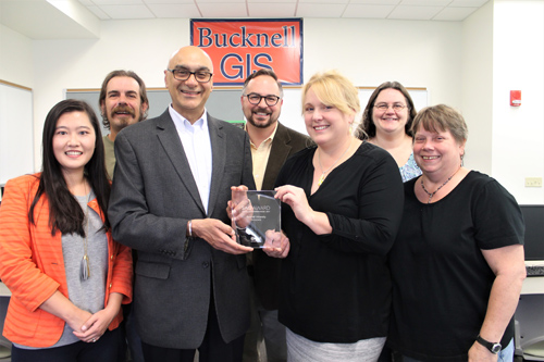
PHOTO PROVIDED Members of Bucknell University’s Digital Pedagogy and Scholarship team display the Special Achievement in GIS (geographic information systems) Award (SAG Award) it received from Esri, the global leader in spatial analytics. Shown, front row from left, are members of the team including Luyang Ren, GIS/web application specialist; Param Bedi, vice president for library and information technology; Janine Glathar, digital pedagogy and scholarship specialist for GIS; and Lorraine Eisenhuth, systems integrator. And back row, from left, are Todd Fogle, senior technology support specialist; Matt Gardzina, director of digital pedagogy and scholarship; and Carrie Pirmann, social sciences librarian.
SAN DIEGO, Calif. — Esri, the global leader in spatial analytics, recently presented Bucknell University’s Digital Pedagogy & Scholarship team with a Special Achievement in GIS (geographic information systems) Award (SAG Award) at its annual Esri User Conference. Selected from over 300,000 eligible candidates, Bucknell received the award for its innovative application of technology, data collection, geospatial information visualization and thought leadership through GIS in the field of higher education.
“The SAG Awards provide a great opportunity to showcase all the outstanding achievements of our users,” said Jack Dangermond, Esri founder and president. “The Special Achievement in GIS Award recognizes exemplary organizations implementing spatial analytics technology to change the world. Highlighting the good work of users — in industries ranging from commerce to government — benefits the entire GIS community, and that’s very valuable.”
Bucknell’s Digital Pedagogy and Scholarship team partners with faculty and students to integrate GIS into courses and research projects, identifies and applies appropriate methodologies, creates spatial datasets, collaborates with faculty on developing course materials and scholarly publications, and helps faculty and students develop GIS technical expertise. The team includes staff from four divisions within Library and Information Technology and over the last eight years has provided support to faculty and students from 28 academic departments and initiatives, 67 courses and 97 research projects.
“Bucknell faculty advocated for GIS support and invited us into their teaching and scholarship,” said Janine Glathar, Bucknell digital pedagogy and scholarship specialist for GIS. “They are the heart of this program and the people, along with our undergraduate students, who deserve the most credit for this award.”
Bucknell was the only organization in the “Libraries and Museums” category to earn a SAG Award, and among just 180 organizations worldwide. Esri staff annually nominate hundreds of candidates from around the world for consideration, and Dangermond selects the finalists.
More information on how Bucknell is innovating through GIS is available at http://showcase.blogs.bucknell.edu/geographic-information-system-gis/
Education
Montoursville high school, Warrensville Lions Club name April students of the month
Montoursville Area High School recognized their April Students of the Month. Myken Barnes and Madison Labatch are ...
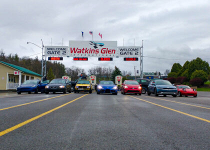
Pennsylvania College of Technology students excel at Toyota Green Grand Prix in Watkins Glen
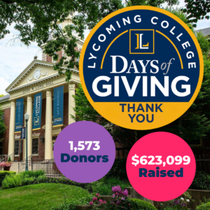
‘Not just dollars raised’: Lycoming surpasses previous years with $623,099 raised during annual Days of Giving
Montgomery Area Jr/Sr High School marking period No. 3 honor rolls
Distinguished Honor Roll: Grade 7 – Aurora Buss, Julianna Cole, Hayden Denton, Brooklyn Dietrick, Gage Furman, ...
Walnut Street Christian School quarter No. 3 honor and merit rolls
Honor Roll 12th grade — Oakton Rosypal 11th grade — Micah Borowicz 10th grade — Dominic Brooks 9th ...
Montgomery Elementary School marking period No. 1 honor rolls
Montgomery Elementary School has recognized students who have excelled academically during the recent marking ...