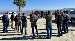
For many years, field crews depended upon paper maps, PDFs and written notes. Today, some companies are moving beyond paper-based documentation to cloud-based technology and tools.
For example, American Transmission Co. (ATC) has been using Esri tools for more than a decade, and last year, the company began using ArcGIS Online tools to improve the productivity of its office and field workforce.
In the past, ATC faced the challenge of consolidating and distributing all the information collected in the field. After transferring all the information to a central geographic information system (GIS), the company had to update the data and reissue the paper and PDF maps, which impacted the timing of the data. Also, the company was not always sure that everyone had the latest hard copy maps, which presented a challenge.
Accessing Real-Time Data
Today, ATC’s field users can see the company’s assets as they are updated, and even more important, they can see the information other groups such as environmental and construction collect while they are in the field.
Crews are collecting information in a consistent manner, and as they are gathering the data, it is available for review by anyone else on the project — both in the field and in the office. As such, productivity has improved, because the employees no longer need to go back and forth with updates and wonder if field crews have the most up-to-date information.
By having one platform to collect data for all of ATC and its contractors, the company can improve safety by having up-to-date information available for all field users. For example, they can have real-time access to information such as hazardous areas or best access routes on their smart phones or tablets.
The new program is easy to learn, and if someone is used to a smartphone, he or she can learn the tools. Even for the aerial patrol application, which uses a ruggedized tablet, it is intuitive for the patrollers and only requires about 15 minutes of training. Because the pilot is trained, he can show the new patrollers how to use the system.
Getting on the Same Page
With the new ArcGIS Online system, ATC can obtain a holistic view by looking at multiple sources of data at one time. The team can review environmental access plans in conjunction with other data to help make decisions, plan access, determine permitting needs and identify constructability concerns.
From an environmental standpoint, using ArcGIS Online is not only a more efficient tool, but it also reduces ATC’s risk of environmental compliance issues. For example, in the past, there was no real-time mechanism to communicate changes to the team. When a decision was made to change a paper map because of weather, landowner concerns or permitting issues, only a few people knew about the change and marked up individual maps. Meanwhile, the rest of the team worked off maps that reflected something different until updated materials could be distributed. With ArcGIS Online, however, ATC can reduce environmental risk and reduce overall risk to the project by having the correct information, in an understandable format, at the right time.
Reaping Benefits
The company can use ArcGIS Online for aerial transmission line inspections in addition to field collections. Before the GIS solution, if ATC’s aerial patrollers detected an issue with a structure, they wrote down the problem on a piece of paper with the structure number. A drawback with this approach, however, was that even though ATC has aerial markers every five to 10 structures, it was highly probable to incorrectly identify structure numbers. This was especially true if only a handful of issues were identified in an eight-hour patrol and if the line was not consistently flown in one direction. Forgotten or uncertain structure numbers required the pilot to circle around and recount, which increased the time and cost of the patrol.
The new GIS system, however, took the guesswork out of the equation and eliminated the need to circle back to recount. It then allows the patroller to look for issues on the line or the structure, click on the location on the map, enter one of the issue types on the menu and keep patrolling.
With this approach, the data collected is accurate, and the field crews who perform the repair can go directly to the problem area. The GIS solution also provides information to the patroller and pilot about which areas to avoid, including confined animal feeding operations, thus reducing the impact to livestock. ATC does three aerial patrols per year with two for structure and transmission line patrolling. The third patrol is specific to vegetation patrolling to look for danger trees and other vegetation issues that may impact the transmission lines.
Looking to the Future
The company also can use the ArcGIS Online system for behavior-based safety observations. In the past, the company used SharePoint forms and PDFs to record information. This approach was very cumbersome and didn’t work well when field users were not connected to a cellular network. The ArcGIS Online system, however, allows for disconnected editing, and the information is pushed to ArcGIS Online when the user is in cellular coverage.
In the future, ATC foresees other possible uses of ArcGIS Online. For example, ATC plans to continue to provide field collection capabilities to other functional users. The company would also like to provide additional dashboards for management to review the data collected in the field and provide alerts for any safety issues. The company can also make technological improvements, including voice recognition and possibly hands-free wearable headsets for augmented reality. ♦
Sidebar: Key Benefits of the New GIS System
By investing in a new GIS system, ATC improved the productivity of its field and office staff in four key areas.
1. Constructability
Before ArcGIS Online: Photos and notes were taken in the field by hand and transcribed in the office. The final notes and photos were matched up and placed in a constructability binder, providing inconsistent access to the team.
After ArcGIS Online: The field notes and photos taken in ArcGIS Online during constructability walk downs can be integrated into an Excel-style checklist or PDF-style report with photos. The ability to update data as constructability reviews are refined gives all team members access to constructability information.
2. Access
Before ArcGIS Online: ATC’s office and field staff printed a hard copy of Environmental Access Plans (EAPs) and marked up access on EAPs with a Sharpie. They would then communicate access to ATC Environmental through a personal meeting or by scanning and emailing the documents. The team then accessed environmental reviews for impacts after an environmental consultant or ATC GIS digitized access. The maps were then rerun as PDFs and printed for review and revision. The access was communicated to the team via hard copy maps or electronic PDFs of maps, which were usually too large to email.
After ArcGIS Online: Access is now drawn in the field during a constructability review or walk down. Because the data is real time and seen by the team, the environmental department can review the information and make the determination immediately.
3. Erosion Control
Before ArcGIS Online: ATC Environmental monitors documented erosion-control status and noted issues through field notes and photos. These observations, which are a regulatory requirement, were transcribed from field notes, matched with photos and formatted as a daily/weekly report. Additionally, the environmental monitor emailed or called to notify crews of a deficient erosion-control device or need for erosion control, and to explain the location and issue at hand. Once the issue was resolved, a follow-up call was made or an email was sent to ATC Environmental for documentation.
After ArcGIS Online: The environmental field monitor makes erosion-control observations and takes photos throughout the monitoring day. Calls are made to notify crews of deficient devices, and they are referred to ArcGIS Online for location and photos. This allows for better assessment of materials and staff resources needed for correcting erosion-control issues. Data is real time and identified as “needs follow up” or “acceptable” accordingly. Weekly reports are run automatically for internal and external distribution.
4. Environmental Reports
Before ArcGIS Online: ATC environmental monitors document compliance status and note issues through field notes and photos. These observations are transcribed from field notes, matched with photos and formatted as a daily/weekly report. Additionally, the environmental monitor would email or call to notify crews of concerns/issues. A follow-up call is made or email sent to ATC Environmental to document once the issue(s) is fixed.
After ArcGIS Online: The environmental field monitor makes environmental observations and takes photos throughout the monitoring day. Calls are made to notify crews of deficient devices and they are referred to ArcGIS Online for location and photos. This allows for better assessment of materials and staff resources needed for correcting issues. Data is real time and identified as “needs follow up” or “acceptable” accordingly. Weekly reports are run automatically for internal and external distribution.
Check out the February 2018 issue for more articles, news and commentary.